Projects
Most of projects are mostly aiming at the use of open standards to manage spatial information and at the integration of various kinds of spatial information. At my current position at the OGC I am participating in several more projects as part of the Collaborative Solutions and Innovation team (e.g. CHEK, ACCORD, USAGE, AD4GD).
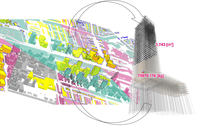
Multisource Spatial data integration for smart city applications (MuSICA)
2020-2022
Funded within the EU Marie Sklodowska-Curie cofund ‘Leading Fellows’ Postdocs Programme, grant agreement No. 707404.
At the 3D geoinformation group, Delft University of Technology (NL).
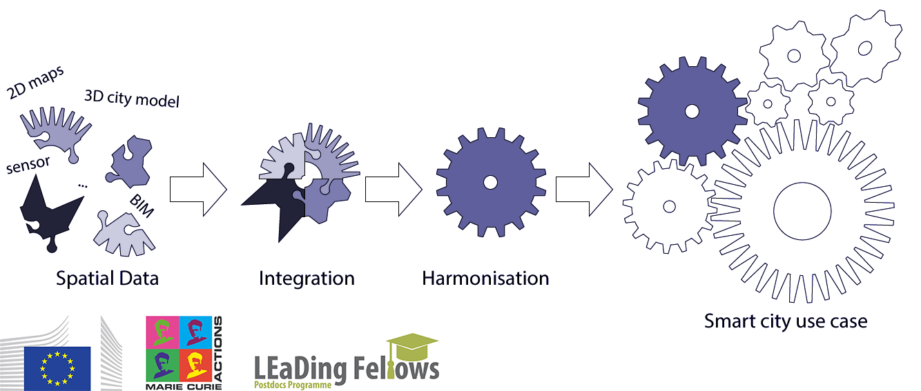
Aim of the project was the generation of an integrated 3D map from the assembly and improvement of integrated spatial information, effective support of specific use cases for smart cities.
It is hard, even for the most effective procedures, to overcome the inhomogeneity of original data sources (e.g. accuracy, choice of the represented details, conventions, semantics).
A methodology was developed, in an interdisciplinary framework, for obtaining 3D maps, suitable for the intended use cases with respect to geometry, semantics and georeferencing, derived from the integration of several kinds of information (e.g. 3D city models, 2D maps, models with design and construction information, sensor data) and from multiple sources (e.g. institutional repositories, open data, citizens).
The methodology developed according to the investigations is published in:
Noardo, F., 2022. Multisource spatial data integration for use cases applications. Transaction in GIS, 26, 7.
European network for Digital Building Permission (EUnet4DBP)

from 2020 (on-going)
Spontaneous organisation of researchers and stakeholders with common interests in the development of a methodology (including guidelines, best practices, tools, and so on) to support the digitisation and the automation of the building permission issuing process.
Our objective will be the definition of a strategy and organization of an international network to develop digital building permission tools and methods in a common effort, with advantages to interoperability, procedures and data optimization and standardization and good implementations.
GeoBIM Building permits
2019-2020
Funded by the Municipality of Rotterdam (Digital city group).
At the 3D geoinformation group, Delft University of Technology (NL).
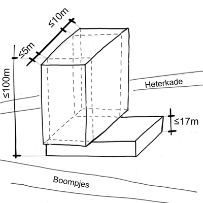
The automation of the regulation checks is further explored by this project, by means of the integrated information from the geospatial domain and the Building Information Models.
In particular, two regulations were chosen for having potentially higher advantages by the system, and higher compliance and effective assessment urgency. These are analysed and translated to more formal languages within workshops and sessions in collaboration with the municipality officers usually devoted to the interpretation of such rules.
A tool was implemented, allowing the automatic or semi-automatic checks of the compliancy to the selected regulations using IFC models as input.
Guidelines and recommendations were also provided, addressed to designers and city modelers, to be followed when building the 3D city models and the building information models involved in the procedure, in order the automation to be successful.
GeoBIM benchmark project
2019
At the 3D geoinformation group, Delft University of Technology (NL).
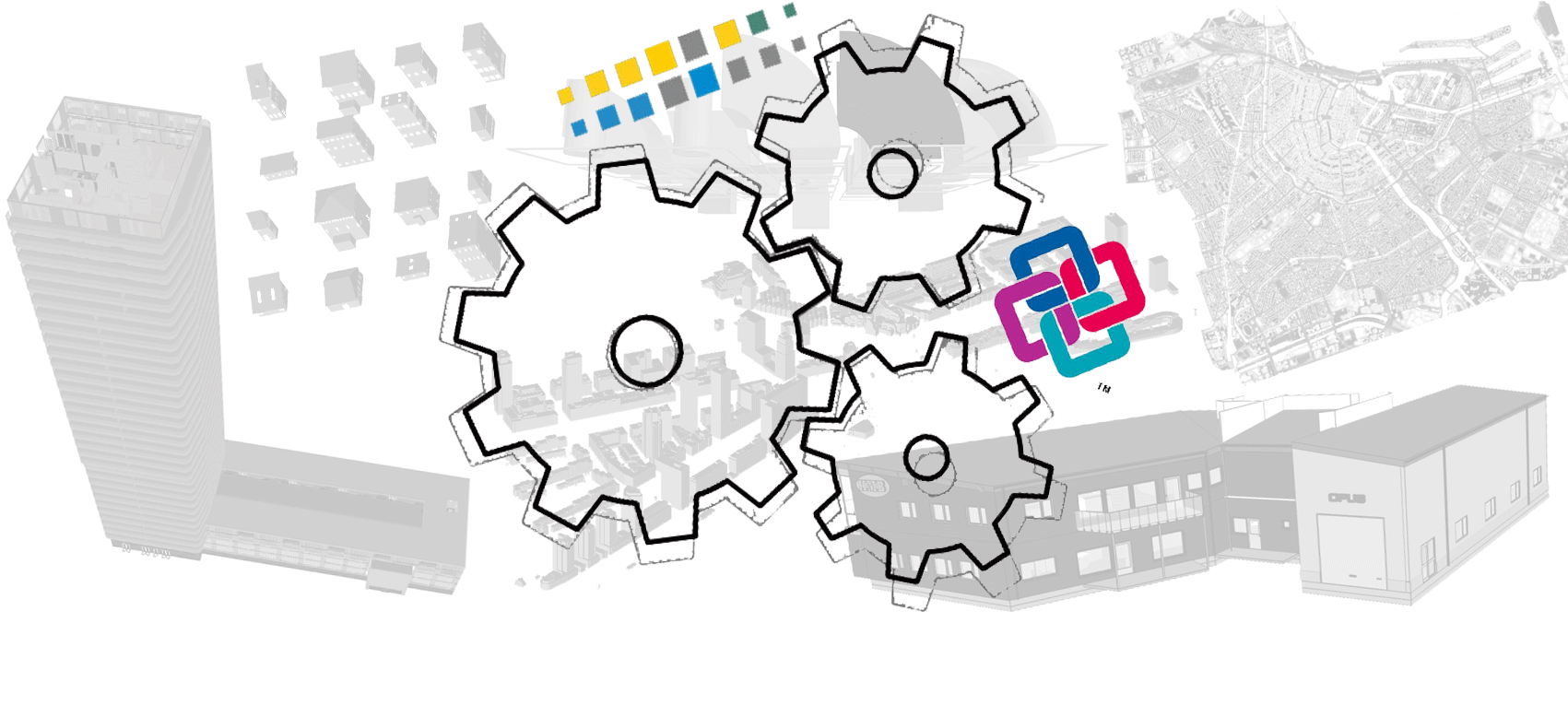
Reference study on software support for open standards of city and building models. This benchmark investigates the available technical solutions to support research and activities related to GeoBIM, through the use of the open standards IFC (by buildingSMART) and CityGML (by OGC):
What is the support for IFC within BIM (and other) software? What options for geo-referencing BIM data are available? What is the support for CityGML within GIS (and other) tools? What options for conversion (IFC↔CityGML) are available?
A wide collaboration with voluntary participants in the world is develop to build a reference as complete as possible and point out both the state of implementation of open standards and the current issues in open standards themselves.
EuroSDR GeoBIM project
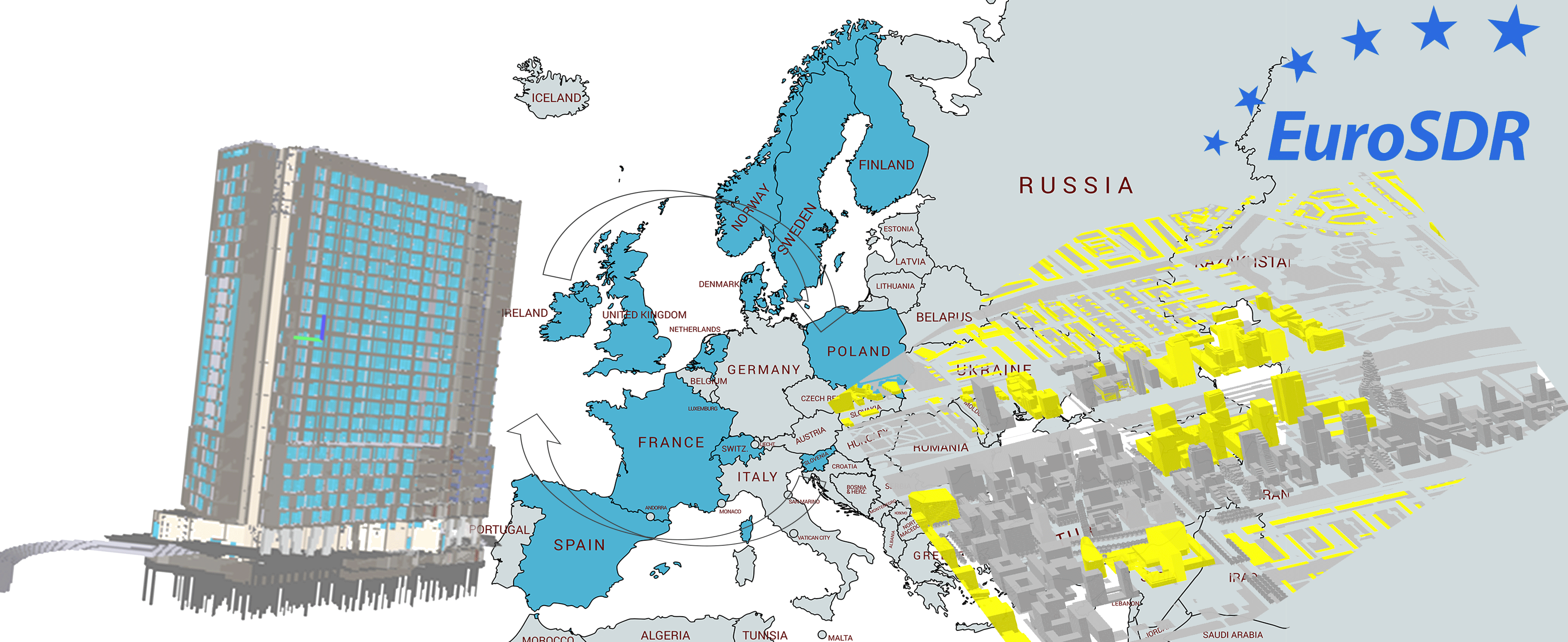
2018-2020
Sponsored by EuroSDR (European agency for Spatial Data Research)
At the 3D geoinformation group, Delft University of Technology (NL).
Collaboration of National Mapping and Cadastral Agencies and Universities from 12 European countries to develop a coherent approach to GeoBIM in connection with stakeholders and current practice.
Two use cases are developed: ‘Building permission issuing’ and ‘Assets and facility management’.
Smart data integration for urban applications
2018-2019
Funded by the Amsterdam Institute for Advanced Metropolitan Solutions (AMS-Institute).
At the 3D geoinformation group, Delft University of Technology (NL).
The project addresses the use of GeoBIM information for applications in an urban environment.
Other projects
Other projects in which I began the study of my current research topics and first explored their applications.
On-going - EU MSC - Cultural Heritage and the Planning of European Landscapes HERILAND At the 3D geoinformation group, Delft University of Technology (NL).
2017-2018 - DG-ECHO - Increasing Resilience of Cultural heritage: a supporting decision tool for the safeguarding of cultural assets ResCult - at Politecnico di Torino (Italy) - DIATI.
2014-2015 - POR-FESR - Internet of Data for Environmental Monitoring IDEM - at Politecnico di Torino (Italy) - DIATI.
2013-2015 - ALCOTRA - Alpes Latines – Identification Ressources HYdriques Souterraines ALIRHYS - at Politecnico di Torino (Italy) - DIATI.